.jpg)
As India and the United States announced the framework for an interim trade agreement on Saturday, a map of India released by the Trump administration drew attention on social media. The map depicted the entire Jammu and Kashmir, including Pakistan-occupied Kashmir (POK), as part of India, and also showed Aksai Chin, which China claims as its territory. India has always maintained that Kashmir is an inalienable part of the country. On previous occasions, maps released by the US or its State Department clearly demarcated the POK, in line with Pakistan’s concerns. The latest map from the Trump administration, however, appears to reject Pakistan’s claims.
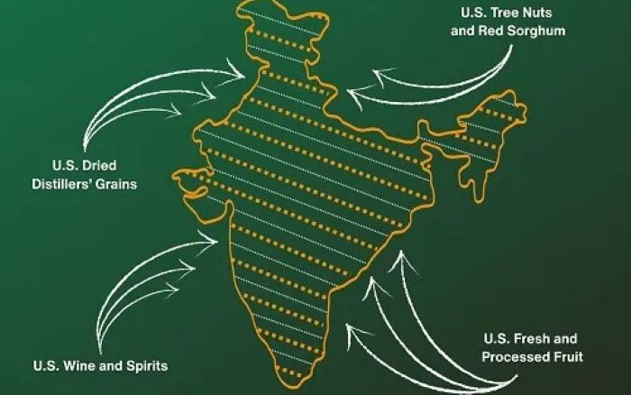
From tree nuts and dried distillers’ grains to red sorghum and fresh and processed fruit, the U.S.-India Agreement will provide new market access for American products. pic.twitter.com/mqpP10LJp1
— United States Trade Representative (@USTradeRep) February 6, 2026
India has consistently objected to the incorrect depiction of India's borders -- specifically Jammu and Kashmir and Arunachal Pradesh -- on maps used by the US State Department and other global agencies. The US's latest move finally takes into consideration India's longstanding concern. Over the last few months, Pakistan army chief, Asim Munir, visiting the US three times. He has also held two meetings with Trump, including a much-publicised lunch in June. It marked the first time a US President engaged Pakistan's army chief alone, without any civilian leadership present.


Related Items
US halves tariffs on India, but at a price: Trade relief meets strategic crossroads
PM Modi hails Tamil as India’s link to world in Malaysia
Trade deal ensures full protection for farmers, Agri products: Goyal