 Newsinc24 Team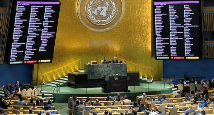
India has voted in favour of a UN General Assembly resolution aimed at correcting the world map to promote a “more accurate representation” of continental landmasses. The 193-member UN General Assembly on Friday overwhelmingly adopted the resolution ‘“Correct the map”: rebalancing global cartographic representation and promoting equitable representation of the world’s regions, particularly Africa’. The resolution was sponsored by Togo and backed by African Union (AU) members, receiving 164 votes in favour, with abstentions from Estonia, Georgia, Lithuania, Moldova, Serbia and Ukraine, and a lone vote against from the United States. Raghoo Puri, First Secretary at India’s Permanent Mission to the UN, said India "welcomes" the intention behind the resolution to promote more accurate and representative cartographic practices. "We believe that maps play an important role in how societies understand geography and the relative scale of the world around us," he said.
#WATCH | New York, US: The United Nations General Assembly officially adopted the 'Correct the Map' resolution by a vote of 164 to 1, marking a historic shift away from the traditional Mercator projection in favor of more accurate, equal-area representations like the Equal Earth… pic.twitter.com/DaN6MlULGK
— ANI (@ANI) September 5, 2026
The UN vote is non-binding, but it will encourage governments and institutions to stop using the traditional Mercator map. The Mercator map, which has been in common use since the 16th Century, has come under criticism as it shows Africa as similar in size to Greenland, even though it is 14 times larger. Critics say this leads to the development needs and potential for countries near the equator to be minimised. The Mercator map was designed in 1569 by the Flemish cartographer Gerardus Mercator to help European explorers navigate across the world. The map makes countries near the poles appear much larger than they really are. The distortion of his map is a result of the fact that it is impossible to accurately represent the surface of a globe on a two-dimensional chart.
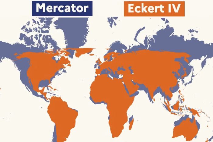
In an effort to correct this, a team of cartographers in 2018 created an equal area map they called the Equal Earth projection, which shows the relative sizes of continents more accurately. In February, the African Union’s 54 member states adopted it and said it more accurately represents the sizes of all continents, particularly Africa.
France has also backed the change and said it plans to stop using the Mercator map. However, the United States criticised the UN vote, arguing that the General Assembly should focus on more serious global issues. Campaigners say maps are more than just guides for travellers, they shape how regions are perceived politically and economically.












Related Items
India firmly supports legal mobility of people, says Jaishankar
The India That Stayed With Gloria Steinem
Sitharaman invites global CEOs to invest in India